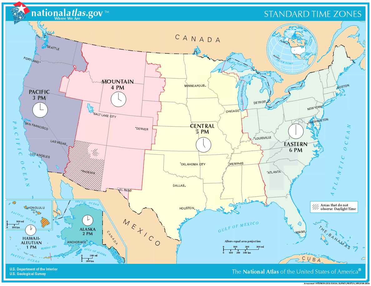
Crazy time zones

Given the width of the USA, it’s no wonder that the country is divided into several time zones.
However, in my European naïveness I had assumed that it worked by each state deciding which time zone it wanted to be in.
This is not at all the case, however. Time zone borders run through the middle of many states (click on the map for details), e.g.:
CST/MST boundary
- divides the southwest portion of North Dakota from the rest of the state
- divides South Dakota roughly in half
- divides the western third of Nebraska from the rest of the state
- divides a very small portion of extreme western Kansas bordering Colorado from the rest of the state
- follows the border between New Mexico (west) and Oklahoma (east)
- follows the border between New Mexico (west) and Texas (east)
- divides El Paso County and Hudspeth County from the rest of Texas
I guess this is to a large extent a result of the randomness of US state borders.